

 JSC Karazhanbasmunai
  Lepes LLP
  KaraKudik
  Dunga Operating GmbH
  JSC QAZAQGAZ AIMAQ
  BNG Ltd LLP
  KMG Barlau LLP
  TENGE Oil & Gas LLP
  Buzachi Neft LLP
  Stroy-Plast-Aktau LLP
  Sofi-Medgroup LLP
  Caspian Cement LLP
  JSC KazAzot
  Caspiy Desalination Plant
  JSC MREK
  HYRASIA ENERGY LLP
  Mangistau Power B.V. Branch
  Port of Aktau
 Service 01
Land plot allocation, subdivision, merger, boundary establishment and changes to identification characteristics across Kazakhstan.
Service page
Learn more Leica, South and DJI equipment. Engineering surveys, land management projects, laser scanning, construction support and reclamation for oil and gas, industrial and public-sector clients.
Trusted by
One contractor and one project manager from receiving the brief to handing over the site.
Land plot allocation, subdivision, merger, boundary establishment and changes to identification characteristics across Kazakhstan.
Topographic surveys, digital terrain models, profiles and GPS measurements: the foundation of a successful construction project.
Setting-out works, as-built surveys and deformation monitoring at every stage of construction — from excavation to final handover of the facility.
Borehole drilling, soil sampling and laboratory analysis — input data on soils, groundwater and seismic conditions for reliable foundation design.
Plate bearing, CPT, DPT and pressuremeter testing — we determine soil properties for reliable foundation design.
Development of land reclamation projects for disturbed lands at oil and gas sites, quarries and industrial facilities, under approved Kazakhstan standards.
Terrestrial laser scanning of buildings, industrial sites and structures — dense point clouds for BIM, measured surveys and as-built documentation across Kazakhstan.
Every contract is managed transparently: deadlines, responsible people and deliverables are clear.
Receiving the application for a land management project.
Collecting archive, cadastral and cartographic materials and carrying out a field inspection.
Preparing the graphic and explanatory parts of the project under Kazakhstan law.
Compiling the project into a single document for approval.
Approval of the land management project by local executive bodies and receipt of title documents.
Setting out the project on site, fixing boundaries and handing results to the client.
Filing an application to receive identification documents (state act) and obtaining registration.
Annual calibration. Suitable for oil and gas and infrastructure project requirements.
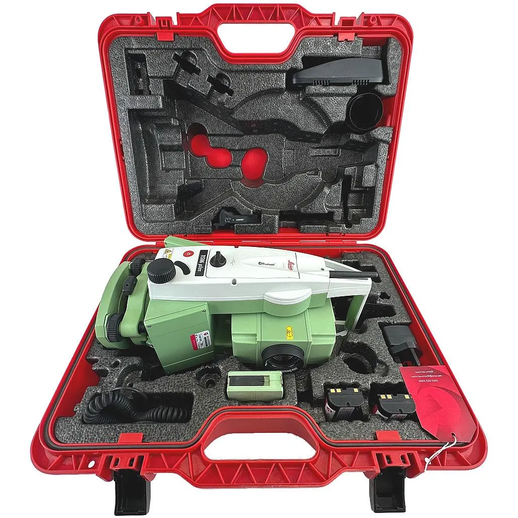
High-precision Leica TS06 total station with 5″ angular accuracy for topographic surveys, setting-out works, as-built surveys and deformation monitoring.
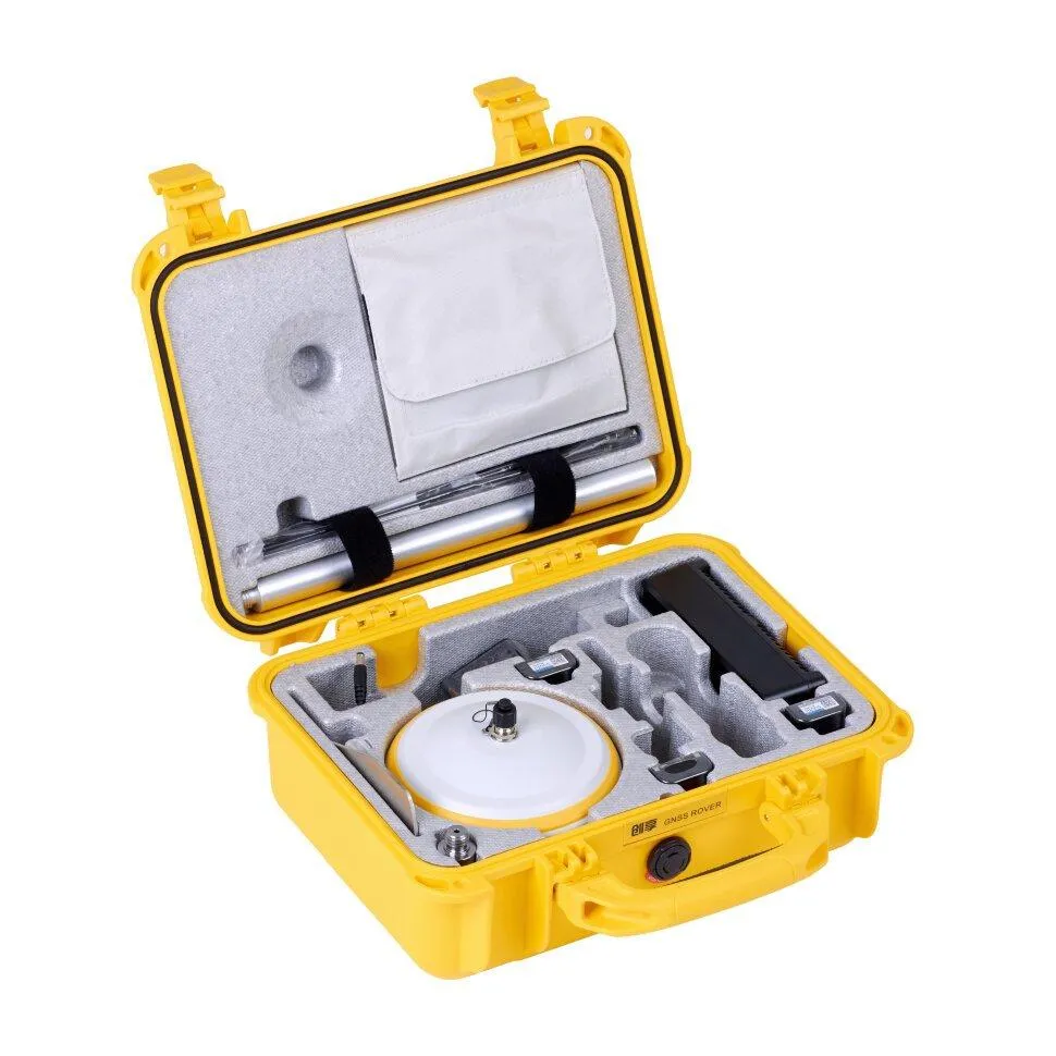
RTK receiver with IMU up to 60°, FIX reliability > 99.99%, base and rover operation.
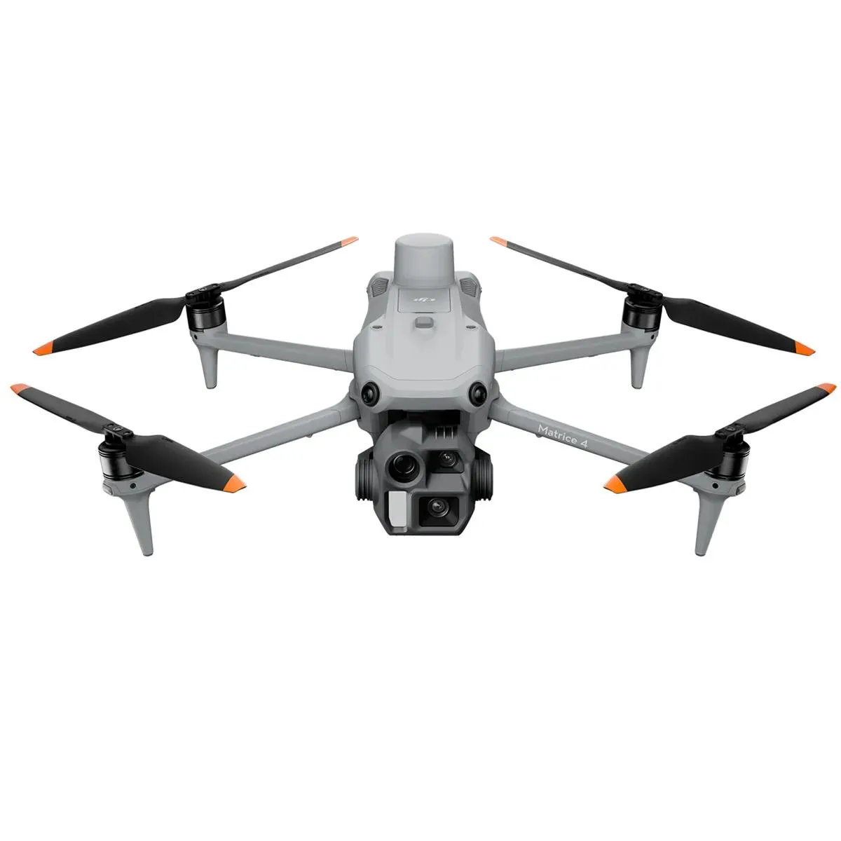
Industrial drone with RTK for aerial mapping, 3D modelling and power line inspection.
The base and desk-processing team are in Aktau; crews travel to site with our own instruments. Kazakhstan law sets no territorial limits on geodetic and land management work.
The Land Code, Geodesy Law, Subsoil Code and Ministry orders form the documentation basis for each project.
Short and direct answers. If your question is not listed, call us directly.
Engineering geodetic surveys, topographic surveys, laser scanning, setting-out and as-built works, engineering geological surveys, land management projects, land cadastral works and reclamation of disturbed land. We work on oil and gas sites, industrial areas, linear facilities and public-sector projects across Kazakhstan.
We work across Kazakhstan. The head office is in Aktau; we regularly mobilise to Mangystau, Atyrau, Aktobe, Karaganda and other regions. Field crews with equipment can deploy to any site in the country.
Yes. GeoProGlobal LLP carries out geodetic works in accordance with Kazakhstan law. The territory of activity is not limited to the region of registration. Works follow statutory requirements for specialists, measuring equipment and the notification procedure. GeoProGlobal LLP (BIN 130440018479) is listed in the Kazakhstan public procurement supplier registry.
Urgent topographic survey of a small site takes 3-7 business days. Complex engineering surveys for design take 3-8 weeks depending on area and complexity. Each site receives a transparent schedule with stages, dates and a responsible project manager.
The fleet includes South G4 GNSS, Leica GS-08 Plus, Leica TS06 Plus total stations, a 3D scanner, DJI Matrice 4E, own drilling rigs (PBU-2 on a SHACMAN 6×6 chassis), CPT/DPT, the Izyskatel 5000 plate and a PEV-89MK pressuremeter. All instruments are verified annually.
Yes. A major part of the portfolio is surveys and land management for oil and gas operators, EPC contractors, akimats and state enterprises. We prepare documentation for expert review requirements and work to tender procedure standards.
We deliver a complete package: technical report under current Kazakhstan standards, DWG/PDF drawings, coordinate catalogs in the required system, optional 3D model, photo and video records of stages and handover acceptance act. Materials are signed electronically by the responsible specialist.
Send the brief or call us and we will return a preliminary site estimate within 24 hours.